Bonaire receives the “Thumbs Up” to host a Galileo Sensor Station for the European Union’s Satellite Navigation System.
Today everyone has heard of GPS and most likely uses it daily, whether or not it is realized. Many people are not aware that there are other satellite navigation systems in development around the world, and one is the Galileo Satellite Navigation System, the largest European space project of all time. It is a global civilian satellite navigation system developed by the European Space Agency (ESA) and the European Union, with greater precision and accuracy than GPS. Bonaire has just been selected to host a Galileo Sensor Station.
About the Galileo Sensor Stations and how they integrate with the entire Galileo system.
There are currently five satellite navigation systems in use around the world, so why do we need another? The reason is that the five systems in use are owned by various countries: The United States owns the GPS system with which we are most familiar, but other systems are owned by Russia, India, China, and Japan, and, at any time, usage of these systems can be blocked by their proprietary owners. Since satellite navigation is so imperative to so many important applications, the EU thought it prudent not to depend upon other countries.
Most satellite navigation systems were originally developed for military use, but civilian applications quickly became everyday occurrences, including maintaining infrastructure, transporting goods, delivering services, or just meeting friends. Today, anyone using a mobile phone is most likely using technology as sophisticated as that used by pilots and soldiers. Navigation has become as easy as asking Google Maps to create directions for you to your Bonaire restaurant of choice for dinner.
So, in 2011, the first Galileo satellite was launched, along with 27 subsequent Medium Earth Satellites, including six spares, now orbiting the earth.
Galileo on the ground.
The Galileo ground segment consists of two Galileo Control Centres (GCC) situated in Oberpfaffenhofen (Germany) and Fucino (Italy). Each of these facilities manages “control functions” as well as “mission functions” including Search & Rescue.
The ground segment determines the navigation and timing data part of the navigation messages by means of a network of GSSs (Galileo Sensor Stations), which collect and forward Galileo measurements and data to the GCCs in real-time. The majority of Galileo Sensor Stations are located in France, but a location in the Caribbean was desired. This is where Bonaire comes into the picture.
Background history for the Bonaire Galileo Sensor Station.
In August 2020, Minister Cora van Nieuwenhuizen of the Netherlands’ Ministry of Infrastructure and Water Management visited Bonaire, along with a survey team of members from the Galileo project, to investigate the suitability of placing a Galileo Sensor Station on Bonaire. During this survey, locations at Bonaire International Airport and the WEB facility at Barcadera were considered.

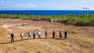
Nearly a year later, last month Minister van Nieuwenhuizen once again visited Bonaire and was able to confirm that Bonaire had been indeed chosen for the Caribbean location of the Galileo Sensor Station with the location at the Barcadera WEB facility, atop the 1000 Steps dive site, selected as the most suitable. This location had previously been used as a solar energy pilot program.
Looking forward to Bonaire’s future in satellite communications and navigation.
The hardware.
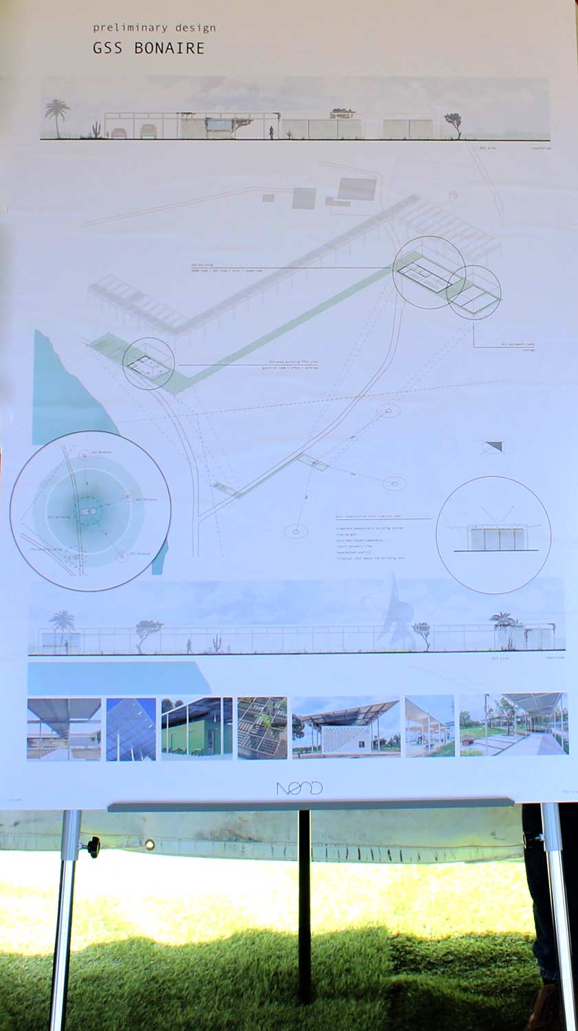
Bonaire’s Galileo Sensor Station will consist of three satellite dishes, each with a diameter of 2.5 meters and an unmanned building with rooms for computers and receivers, storage, office space, and a guardhouse for security personnel.
The expertise of personnel for construction and management.
Special expertise will be required for the construction of the Galileo Sensor Station because the construction must be carried out under strict European Union conditions. If the workforce is not available on Bonaire, expertise will be sourced elsewhere. The strict requirements apply not only to the construction but also to the maintenance and operational services of the station after it goes online. EUSPA (European Union Agency for the Space Programme) will train the personnel who will manage Bonaire’s Galileo Sensor Station.
Keeping Bonaire’s nature safe.
In the framework of innovation and nature, the Ministry of Infrastructure and Water Management will set up a Nature Committee in which RVB, OLB, WEB, and STINAPA will actively participate with the joint mission of finding a balance between the placement of the Galileo Sensor Station and the existing nature. By combining expertise and joining forces, excellent integration of the building into the environment can be ensured.
A giant stride for Bonaire with the possibility to add a Telemetry Tracking and Command Center.
The expectation is that the construction of the Galileo Sensor Station will commence mid-2022, and Bonaire’s Galileo Sensor Station signals an innovative step for the island’s future in space and satellite data. The Ministry of Infrastructure and Water Management is also proposing the future addition of a Telemetry Tracking and Command Center (TT&C) for Bonaire. Should this be approved, the next step for Bonaire’s integration within aerospace and satellite data development could be ensured. Such a facility provides the connection between the satellites and the ground facilities, and it monitors the status, controls, and determines the locations of the Galileo system’s satellites. More information is expected on this possible component next month.
Do you use Galileo?
The answer to that question is most likely a “yes,” even if you are not aware of your use of the system. If you own a mobile phone, and who doesn’t these days, your phone will have the hardware to use the Galileo system. Depending upon your location around the world, the chances are high that you are using Galileo in some form.
(Source: RCN)


