Where is Bonaire?
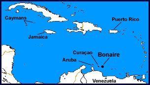
Bonaire is a small island, covering roughly 111 square miles, with a width that ranges from 3 to 7 miles and a length of approximately 24 miles. Bonaire is located approximately 50 miles off of the coast of Venezuela. Bonaire is the B of the ABC islands with her sister islands of the Dutch Caribbean – Aruba, and Curacao. Bonaire’s position on the globe is (in latitude/longitude from a GPS): 12°10′ N 68°17′ W.

Bonaire’s highest point.
Bonaire is a relatively flat island, with its highest point, Brandaris, (located in the Washington Slagbaai National Park), peaking at a mere 780 feet (240 meters).
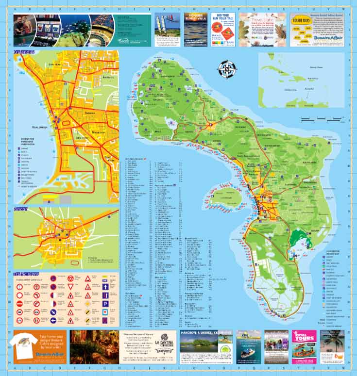
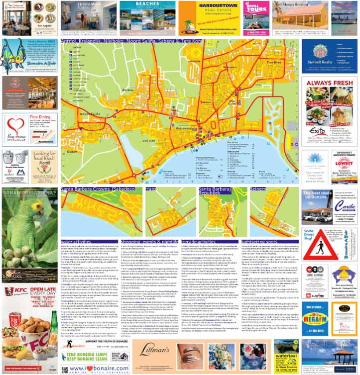
Maps of Bonaire and its main town, Kralendijk.
Bonaire and Kralendijk maps are courtesy of Bonaire Affair. Visit their website to view the maps in a larger format.
The geological history of Bonaire.
It’s been speculated that the island was formed relatively recently, in terms of the age of the earth, anyway. Apparently, as the nearby continental shelf in the area (now located near Montserrat, and the cause of the volcanic activity on that island) moved through the area, it forced a large mass of rock to the surface, creating the islands of the Lesser and Greater Antilles. Some of this activity also unleashed molten rock, which explains some of the volcanic formations you might see on Bonaire. However, since the continental shelf has passed us by, there’s no real threat of volcanic activity on Bonaire these days.
The beginning of the coral reef structure.
At some point, after the island formed, the earth ocean’s covered the entire island, allowing vast amounts of coral to grow across the top of the island. As the waters receded, the corals exposed to air perished, and over the millennia, became surface limestone deposits. Walking along Bonaire’s shores and the inland, you can see vast amounts of coral skeletons as a result.
However, the remaining corals around Bonaire stayed, resulting in a natural fringing reef system. What this means is that in most places around Bonaire (in particular the calmer leeward side of the island) the reef system starts where the water does. Tide variations are only about 1.8 – 2.0 feet, so the corals start at the low tide line and continue on, following the underwater topology of the island’s base. It should be noted that Bonaire’s tides are more affected by a combination of wind and low/ high-pressure systems than they are by the moon.
Klein Bonaire (or “Little Bonaire).
Klein Bonaire, the small island in the sheltered lee of Bonaire (see map above), has the same geological history, and while Bonaire at least has some hills, Klein Bonaire’s surface is pretty much level, just a few feet above high tide. And, because the island is undeveloped, the fringing reef system surrounding Klein Bonaire is truly pristine.
Additional maps:
Find out information about specific Dive and Snorkel sites.
Learn more about the Bara di Karta drive, hike, and bike trails.
Discover the Rincon Valley drive, hike, and bike trails.
Explore Bonaire by cycling and mountain biking.
Wander around Kralendijk on a self-guided tour of the historical monuments.


